GeoToolbox
Technical Guides & other documentation
GeoToolbox
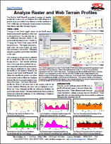
Analyze Raster and Web Terrain Profiles
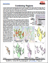
Combining Regions
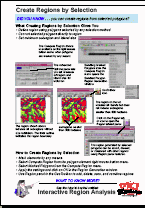
Create Regions by Selection
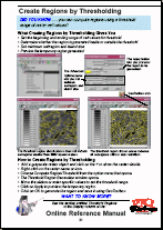
Create Regions by Thresholding
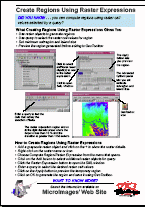
Create Regions Using Raster Expressions
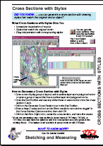
Cross Sections with Styles
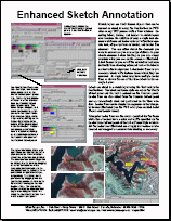
Enhanced Sketch Annotation
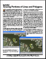
Erasing Portions of Lines and Polygons
GeoToolbox
Graph Values from Multiple Rasters/Terrains by Location
Interactive Region Analysis
Points, Multi-Points, and Options
Profile Views
Regions from Group, Layer, and View Extents
Show/Hide Areas of Interest
Toolbox Measurements and Regions
Tutorial: Sketching & Measuring
(28 pp)
Update Raster Histograms
Use Active/Marked Elements for Measurement, Sketch, and ...
(2 pp)
View Raster and Web Terrain Profiles
Analyze Raster and Web Terrain Profiles
Combining Regions
Create Regions by Selection
Create Regions by Thresholding
Create Regions Using Raster Expressions
Cross Sections with Styles
Enhanced Sketch Annotation
Erasing Portions of Lines and Polygons
GeoToolbox
Graph Values from Multiple Rasters/Terrains by Location
Interactive Region Analysis
Points, Multi-Points, and Options
Profile Views
Regions from Group, Layer, and View Extents
Show/Hide Areas of Interest
Toolbox Measurements and Regions
Tutorial: Sketching & Measuring
Update Raster Histograms
Use Active/Marked Elements for Measurement, Sketch, and ...
View Raster and Web Terrain Profiles