Orthorectification & DEM Extraction
Technical Guides & other documentation
Airphotos contain systematic distortions caused by camera angle, distance, and surface elevation. As a result, their internal geometry differs from the ideal geometry of map products and therefore they are of limited use in professional geospatial analysis.
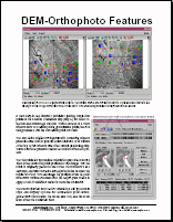
TNTmips has tools for creating an orthoimage by applying elevation information (DEM) to a stereo pair of airphoto imagery. Orthophotos have map-like geometry and provide an accurate image base for many projects in geospatial analysis.