Download TNTscript & Geoprovisioning Package
Automate geospatial processing using local or cloud computing resources
Download TNTscript
TNTscript allows powerful and efficient geospatial processes to be integrated into complex automated work–flows and custom programs. Leverage the power of the TNTgis SML scripting language across your enterprise network or the internet to automatically create geospatial products as new data arrives or by user requests.
See also: TNTscript
Technical Guide: Automated Geospatial Processing with TNTscript
A professional license for TNTscript, TNTmips, or TNTedit is required.
| TNTscript 2018 | |
|
|
TNTscript_2018_Win64_20200115.exe |
| TNTscript 2017 | |
|
|
TNTscript_2017_Win64_20181219.exe |
Download Geoprovisioning Package
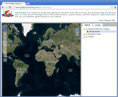
The customizable provisioning system package includes the scripts, interface files, and instructions needed to set up a geoprovisioning system on your own website with a TNTscript license. You can edit the main provisioning page (PHP file) to customize the web interface.
See also: Geoprovisioning
Instructions: Setting up a TNTscript Image Provisioning System
Try it: Geoprovisioning Site
TNTscript is required.
| Customizable Geoprovisioning Package | |
|
|
Geoprovision20151105.zip |